Lodging nearby SHA Mansion
Pakistan
Lodging nearby SHA Mansion
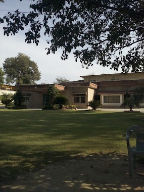
SHA Mansion
Parade Lane، Bilal Omer Shaheed Colony - Parade Lane Rawalpindi, Punjab 46000, Pakistan
contacts phone
:
+92
Latitude:
33.5981933
, Longitude:
73.0372071
larger map & directions
read more
nearest Lodging
250 m
ASC Officers Mess
297 Peshawar Road, Rawalpindi
Lodging
read more
415 m
AMC Officer Mess Rawalpindi
Rawalpindi
Lodging
read more
557 m
Army Medical College Boys Hostel
opposite to CSD, Abid Majeed Road, Rawalpindi
Lodging
read more
614 m
Qasim Coy. Amc Boys Hostel
Rawalpindi
Lodging
read more
618 m
AFIC Mess
opposite roomi park
Lodging
read more
638 m
Army Transit Camp Officers Mess
5 Roomi Road, Rawalpindi
Lodging
read more
644 m
Qasim Company AMC
Rawalpindi
Lodging
read more
669 m
Ayub Company
Rawalpindi
Lodging
read more
706 m
Razi Company
Rawalpindi
Lodging
read more
815 m
QMG Flats
Rawalpindi
Lodging
read more
873 m
AM College Girls Hostel
Abid Majeed Road, Rawalpindi
Lodging
read more
930 m
AL Karam Hotel
Rawalpindi
Lodging
read more
963 m
Railway Officers Rest House
Rawalpindi
Lodging
read more
991 m
Race Course Apartments
Race Course Rd, Rawalpindi
Lodging
read more
1.033 km
roze hotel
Rawalpindi
Lodging
read more
1.067 km
Infantry Mess
Rawalpindi
Lodging
read more
1.076 km
Al Touheed Hotel
Railway Station Road, Rawalpindi
Lodging
read more
1.268 km
Hotel Saeed Village
29/Kashmir Road,Service Rd, Rawalpindi
Lodging
read more
1.275 km
mashallah naan centre
Rawalpindi
Lodging
read more
1.323 km
Islamabad Hotel
Bank Road, Rawalpindi
Lodging
read more
1.432 km
Al-Mehr Hotel
Near Railway Station, Building 2115-2116, Maulvi Mohammad Hussain Rd, Ahata Sheikh Fazal Elahi, Saddar, Rawalpindi
Lodging
read more
1.625 km
Bolan Hotel
Railway Rd, Railway Station, Saddar, Rawalpindi
Lodging
read more
1.643 km
Khalid Cottage
Sajid Bukhari Road, Rawalpindi
Lodging
read more
1.949 km
maghrib hotel
City-Sadar Road, Rawalpindi
Lodging
read more
2.393 km
New Kashmir International Hotel
Liaqat Road, Rawalpindi
Lodging
read more
📑
all categories
Accounting
Administrative area level 1
Administrative area level 2
Airport
Amusement park
Aquarium
Art gallery
Atm
Bakery
Bank
Bar
Beauty salon
Bicycle store
Book store
Bowling alley
Bus station
Cafe
Campground
Car dealer
Car rental
Car repair
Car wash
Casino
Cemetery
Church
City hall
Clothing store
Colloquial area
Convenience store
Courthouse
Dentist
Department store
Doctor
Electrician
Electronics store
Embassy
Finance
Fire station
Florist
Food
Funeral home
Furniture store
Gas station
General contractor
Grocery or supermarket
Gym
Hair care
Hardware store
Health
Hindu Temple
Home goods store
Hospital
Insurance agency
Intersection
Jewelry store
Laundry
Lawyer
Library
Light rail station
Liquor store
Local government office
Locality
Locksmith
Lodging
Meal delivery
Meal takeaway
Mosque
Movie rental
Movie theater
Moving company
Museum
Natural feature
Neighborhood
Night club
Painter
Park
Parking
Pet store
Pharmacy
Physiotherapist
Place of worship
Plumber
Point of interest
Police
Political
Post office
Premise
Real estate agency
Restaurant
Roofing contractor
Route
Rv park, camping
School
Shoe store
Shopping mall
Spa
Stadium
Storage
Store
Sublocality
Subway station
Supermarket
Taxi stand
Train station
Transit station
Travel agency
University
Veterinary care
Zoo
administrative area level 3
sublocality level 1
sublocality level 2
sublocality level 3
↑