places in Hafizabad
Pakistan
Hafizabad
Hafizabad
Administrative Region:
Punjab
population:
245 784
calling code:
+92-547
postcode:
52110
Location on the map of Pakistan
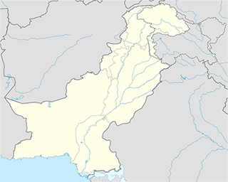
Hafizabad
Accounting
District Accounts Office
Hafizabad, Punjab
Accounting
read more
Atm
Muslim Commercial Bank (MCB)
BV9S4 Street Number 4, Hafizabad
Atm
read more
Soneri Bank Limited
Sagar Road, Hafizabad
Atm
read more
National Bank Of Pakistan (NBP)
Hafizabad
Atm
read more
Askari Bank
Sagar Road, Hafizabad
Atm
read more
United Bank Limited (UBL)
BV9S4 Street Number 4, Hafizabad
Atm
read more
Allied Bank limited (ABL)
Hafizabad
Atm
read more
JS Bank
Hafizabad
Atm
read more
AlBaraka Bank Limited
Hafizabad
Atm
read more
Bakery
Gourmet Sweets and Bakers
Jalalpur Bhattian Road, Hafizabad
Bakery
read more
Nizam sweets house
Hafizabad
Bakery
read more
Rahat Sweets and Bakers
Jalalpur Bhattian Road, Hafizabad
Bakery
read more
Alrehman Bakers
Gujranwala Road, Hafizabad
Bakery
read more
Hakam Sweets and Bakers
Post Office Road, Hafizabad
Bakery
read more
Punjab Pure Milk Mart And Sweets
Hafizabad
Bakery
read more
Al Syed Bakers
Gujranwala Road, Hafizabad
Bakery
read more
Gourmet Bakers
Gujranwala Road, Hafizabad
Bakery
read more
Atif Sweets
Gujranwala Road, Hafizabad
Bakery
read more
Raja Chowk
Post Office Road, Hafizabad
Bakery
read more
Beauty salon
A-ONE Beauty Parlor For Mens
Kassoki Road, Hafizabad
Beauty salon
read more
Al Rehman Beauty Saloon
Jalalpur Bhattian Road, Hafizabad
Beauty salon
read more
Alnasir Beauty Care Center
Hafizabad
Beauty salon
read more
Book store
Arif Book Centre
Sheikhupura Road, Hafizabad
Book store
read more
Bismillah Medical Store
Chak Chatha Road, Doaba Village
Book store
read more
Naveed Book Palace
Gujranwala Road, Hafizabad
Book store
read more
📑
Hafizabad all categories
Accounting
Atm
Bakery
Bank
Beauty salon
Book store
Bus station
Cafe
Campground
Car dealer
Car rental
Car repair
Car wash
Cemetery
Church
City hall
Clothing store
Colloquial area
Convenience store
Courthouse
Dentist
Department store
Doctor
Electrician
Electronics store
Finance
Fire station
Food
Furniture store
Gas station
General contractor
Grocery or supermarket
Gym
Hair care
Health
Home goods store
Hospital
Jewelry store
Library
Local government office
Locality
Lodging
Mosque
Movie theater
Natural feature
Neighborhood
Night club
Park
Parking
Pharmacy
Place of worship
Point of interest
Police
Political
Post office
Premise
Restaurant
Route
Rv park, camping
School
Shoe store
Shopping mall
Stadium
Store
Supermarket
Train station
Transit station
Travel agency
University
Veterinary care
administrative area level 3
sublocality level 1
↑