places in Dera Ismail Khan
Pakistan
Dera Ismail Khan
Dera Ismail Khan
Administrative Region:
Khyber Pakhtunkhwa
population:
217 457
calling code:
+92-966
postcode:
29050
Location on the map of Pakistan
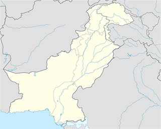
Dera Ismail Khan
Insurance agency
State Life Insurance Office
Bannu Road, Near Kamran Hotel, Dera Ismail Khan
Insurance agency
read more
The United Insurance Company Of Pakistan Ltd
West Circular Road, Dera Ismail Khan
Insurance agency
read more
Movie rental
IQRA Photostat, Computer & Stationery Shop
Dera Ismail Khan
Movie rental
read more
Police
City Police Station سٹی تھانہ
Dera Ismail Khan
Police
read more
Rescue 15 Police post
Topanwala Bazar, Dera Ismail Khan
Police
read more
Saddar Police Station
NH 55, Dera Ismail Khan
Police
read more
Police Station
Dera Ismail Khan
Police
read more
Police Lines
Basti Ustrana (Northern)
Police
read more
Chogallia
Bazar Kalan, Khyber Pakhtunkhwa, Dera Ismail Khan
Police
read more
Post office
Pakistan Post Office
Tijarat ganj branch, Tank adda, West Circular Road, Dera Ismail Khan
Post office
read more
GPO D.I.Khan
Dera Ismail Khan
Post office
read more
General Post Office (GPO)
Dera Ismail Khan
Post office
read more
Premise
High Court
Dera Ismail Khan
Premise
read more
Ali Surgical Hospital
Dera Ismail Khan
Premise
read more
Titanic Ship
Dera Ismail Khan
Premise
read more
Madinah Market
Dera Ismail Khan
Premise
read more
Central Jail
Dera Ismail Khan
Premise
read more
Polo ground
Dera Ismail Khan
Premise
read more
Govt Wheat Godown
Dera Ismail Khan
Premise
read more
Tehsil Nazim Office
Dera Ismail Khan
Premise
read more
Chan mari Shooting area
Dera Ismail Khan
Premise
read more
Army Golf Course
Dera Ismail Khan
Premise
read more
Commisioner Colony
Dera Ismail Khan
Premise
read more
Faisal Nadeem Shaheed Chowk
Basti Ustrana (Northern)
Premise
read more
DCO/ACO Office
Dera Ismail Khan
Premise
read more
Cantt Market
Dera Ismail Khan
Premise
read more
F.G High School
Dera Ismail Khan
Premise
read more
📑
Dera Ismail Khan all categories
Airport
Amusement park
Atm
Bakery
Bank
Bar
Book store
Bus station
Cafe
Car dealer
Car rental
Car repair
Cemetery
Church
City hall
Clothing store
Colloquial area
Courthouse
Dentist
Department store
Doctor
Electronics store
Finance
Food
Furniture store
Gas station
General contractor
Grocery or supermarket
Gym
Hair care
Hardware store
Health
Hindu Temple
Home goods store
Hospital
Insurance agency
Jewelry store
Library
Local government office
Locality
Lodging
Mosque
Movie rental
Natural feature
Neighborhood
Night club
Park
Parking
Pet store
Pharmacy
Place of worship
Point of interest
Police
Post office
Premise
Real estate agency
Restaurant
Route
School
Shoe store
Shopping mall
Stadium
Store
Supermarket
Travel agency
University
Veterinary care
administrative area level 3
sublocality level 1
↑