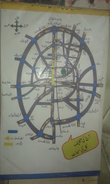
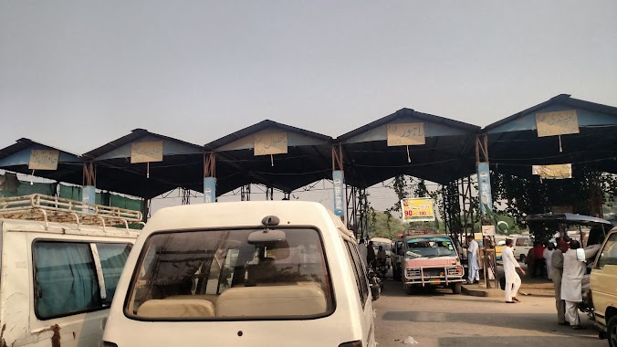
Bus station nearby Kamoke Bus Stop
Pakistan
Bus station nearby Kamoke Bus Stop
Kamoke Bus Stop
Service Road, Kāmoke Pakistan
contacts phone
:
+92
Latitude:
31.973325
, Longitude:
74.2230749
read more
nearest Bus station
8.761 km
More Eminabad Bus Stop
Service Road, Eminabad More
Bus station
read more
13.719 km
Wapda Town Bus Stop
Gujranwala
Bus station
read more
15.785 km
Nagal Adaa Bus Stop
Nangal Saday
Bus station
read more
16.434 km
Budhanke
N-5
Bus station
read more
16.998 km
Khiyali Adda Bus Stop
Khiyali Adda, Sheikhupura Road, Gujranwala
Bus station
read more
17.01 km
Khiyali Bus Stop
Gujranwala
Bus station
read more
19.017 km
Local Bus Station
GT Road, Muridke
Bus station
read more
19.551 km
Star Travel, Sheikhupura More
Sheikhupura More,, Gujranwala
Bus station
read more
19.622 km
Sheikhupura Mor Bus Stop
Gujranwala
Bus station
read more
19.856 km
Bangla Puli Bus Stop
Muridke
Bus station
read more
20.578 km
Zamindar Travels
Farid Town Bridge, Gujranwala
Bus station
read more
20.895 km
Sialkot Ada
Gujranwala
Bus station
read more
20.905 km
Daska Vans Station
Gujranwala
Bus station
read more
21.343 km
Tembar Market
Muridke
Bus station
read more
21.578 km
Aalim Chowk Van Stand
Gujranwala
Bus station
read more
21.669 km
Aalim Chowk Van Stand-2
Gujranwala
Bus station
read more
22.414 km
Gujranwala Bus Station
General Bus Stand Rd, Gujranwala
Bus station
read more
22.424 km
City Tour Bus Stop
G.T. Road, Gujranwala
Bus station
read more
23.373 km
Qazi Kot Bus Stop
Gujranwala - Hafizabad Road
Bus station
read more
24.305 km
Hussain Town Bus Stop
GT Road, Kala Shah Kaku
Bus station
read more
24.522 km
Ravi Rayon Bus Stop
GT Road, Kala Shah Kaku
Bus station
read more
24.564 km
Siddiqui Stop
siddiqui stop Grand Trunk Road, Gujranwala
Bus station
read more
24.916 km
University of Punjab Gujranwala Campus Bus Stop
Gujranwala
Bus station
read more
25.36 km
Kotli Peer Ahmad Shah Bus Stop
N-5, Gujranwala
Bus station
read more
34.987 km
PSO Pump Bus Stop
Jandiala Road, Sheikhupura
Bus station
read more
📑
all categories
Accounting
Administrative area level 1
Administrative area level 2
Airport
Amusement park
Aquarium
Art gallery
Atm
Bakery
Bank
Bar
Beauty salon
Bicycle store
Book store
Bowling alley
Bus station
Cafe
Campground
Car dealer
Car rental
Car repair
Car wash
Casino
Cemetery
Church
City hall
Clothing store
Colloquial area
Convenience store
Courthouse
Dentist
Department store
Doctor
Electrician
Electronics store
Embassy
Finance
Fire station
Florist
Food
Funeral home
Furniture store
Gas station
General contractor
Grocery or supermarket
Gym
Hair care
Hardware store
Health
Hindu Temple
Home goods store
Hospital
Insurance agency
Intersection
Jewelry store
Laundry
Lawyer
Library
Light rail station
Liquor store
Local government office
Locality
Locksmith
Lodging
Meal delivery
Meal takeaway
Mosque
Movie rental
Movie theater
Moving company
Museum
Natural feature
Neighborhood
Night club
Painter
Park
Parking
Pet store
Pharmacy
Physiotherapist
Place of worship
Plumber
Point of interest
Police
Political
Post office
Premise
Real estate agency
Restaurant
Roofing contractor
Route
Rv park, camping
School
Shoe store
Shopping mall
Spa
Stadium
Storage
Store
Sublocality
Subway station
Supermarket
Taxi stand
Train station
Transit station
Travel agency
University
Veterinary care
Zoo
administrative area level 3
sublocality level 1
sublocality level 2
sublocality level 3
↑