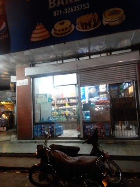
Bakery nearby Subhanallah Bakery
Pakistan
Bakery nearby Subhanallah Bakery
Subhanallah Bakery
Seari Quarters, Karachi, Karachi City, Sindh, Pakistan
contacts phone
:
+92
Latitude:
24.8554444
, Longitude:
67.008877
larger map & directions
read more
nearest Bakery
16 m
Bombay Nimco ( Light House )
Kutchery Road, Karachi
Bakery
read more
202 m
Anjarwala Bakery
Tayyabjee Road, Karachi
Bakery
read more
233 m
Pakistan Confectioners & Bakery
Ellenborough Street, Karachi
Bakery
read more
242 m
Al - Abbas bakery
Shahrah-e-Liaquat, Karachi
Bakery
read more
387 m
Makkah Bakery
Bandgali Outram Road, Karachi
Bakery
read more
414 m
Gulbahar Bakery
Bandgali Outram Road, Karachi
Bakery
read more
488 m
Malik Bakery ملک بیکری
Karachi
Bakery
read more
580 m
Master Cakes
Shahrah-e-Liaquat, Karachi
Bakery
read more
594 m
Fresco Bakers
Shahrah-e-Liaquat, Karachi
Bakery
read more
603 m
Yousuf Bakery
Bam Bridge Road, Karachi
Bakery
read more
609 m
Bhashani Sweets
Karachi
Bakery
read more
650 m
Allah Wali Bakers
Mohammad Bin Qasim Rd, Saddar Town, Karachi, Sindh
Bakery
read more
716 m
Dehli Sweet & Bakers
Kazi Khuda Bakhsh Road, Karachi
Bakery
read more
722 m
shamshad bakery
Shahrah-e-Liaquat, Karachi
Bakery
read more
785 m
Madina Bakery
Karachi
Bakery
read more
815 m
Saleem Bakery
Karachi
Bakery
read more
885 m
Modern Bakery
Karachi
Bakery
read more
927 m
Dilpasand Sweets
Karachi
Bakery
read more
996 m
Khairabad Bakery
Karachi
Bakery
read more
1.08 km
Adam Bakery
Karachi
Bakery
read more
1.221 km
Awami Bakers And Confectioners
4/427 Rew Rajlal Street, Karachi
Bakery
read more
1.314 km
Makkah Bakery
Moulvi Usman Road, Karachi
Bakery
read more
1.623 km
Fahran Bakery
Karachi
Bakery
read more
1.822 km
United Baker & Sweet
Nishtar Road, Karachi
Bakery
read more
1.885 km
Mothers Care Bakery
Yellow Street, Karachi
Bakery
read more
📑
all categories
Accounting
Administrative area level 1
Administrative area level 2
Airport
Amusement park
Aquarium
Art gallery
Atm
Bakery
Bank
Bar
Beauty salon
Bicycle store
Book store
Bowling alley
Bus station
Cafe
Campground
Car dealer
Car rental
Car repair
Car wash
Casino
Cemetery
Church
City hall
Clothing store
Colloquial area
Convenience store
Courthouse
Dentist
Department store
Doctor
Electrician
Electronics store
Embassy
Finance
Fire station
Florist
Food
Funeral home
Furniture store
Gas station
General contractor
Grocery or supermarket
Gym
Hair care
Hardware store
Health
Hindu Temple
Home goods store
Hospital
Insurance agency
Intersection
Jewelry store
Laundry
Lawyer
Library
Light rail station
Liquor store
Local government office
Locality
Locksmith
Lodging
Meal delivery
Meal takeaway
Mosque
Movie rental
Movie theater
Moving company
Museum
Natural feature
Neighborhood
Night club
Painter
Park
Parking
Pet store
Pharmacy
Physiotherapist
Place of worship
Plumber
Point of interest
Police
Political
Post office
Premise
Real estate agency
Restaurant
Roofing contractor
Route
Rv park, camping
School
Shoe store
Shopping mall
Spa
Stadium
Storage
Store
Sublocality
Subway station
Supermarket
Taxi stand
Train station
Transit station
Travel agency
University
Veterinary care
Zoo
administrative area level 3
sublocality level 1
sublocality level 2
sublocality level 3
↑