places in Mingora
Coronavirus disease (COVID-19) Situation
confirmed cases
1581936
deaths
30664
Pakistan
Mingora
Mingora
Administrative Region:
Khyber Pakhtunkhwa
population:
331 091
calling code:
+92-536
postcode:
19130
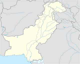
Location on the map of Pakistan
Mingora
Administrative area level 1
Khyber Pakhtunkhwa
Pakistan
Administrative area level 1
read more
Mosque
Teli Abad Big Mosque
Kanju
Mosque
read more
Kanju Chowk Masjid
2 Airport Rd Kanju Riyan Kanju 19130 Airport Road Kanju Riyan, Kanju
Mosque
read more
Dherakai masjid (qahir)
Mamdherai
Mosque
read more
Amir Nawab Khan Battai Jumat
Mohalla Amir Nawab Khan Daulat Khel, Battai, Mingora
Mosque
read more
Abubakar Masjid
Pakistan, Mamdherai
Mosque
read more
Old Masjid
Mamdherai
Mosque
read more
اسلامک تبلیقی مرکز
Mingora
Mosque
read more
Amanullah Khan
Mingora
Mosque
read more
Kokaria
Mingora
Mosque
read more
جامع مسجد مکان باغ
Mingora
Mosque
read more
Jami Masjid
Mingora
Mosque
read more
Masjed AllahoAkbar
Mingora
Mosque
read more
Gul Kada
Mingora
Mosque
read more
Dabba Masjid
Main Bazar, Mingora
Mosque
read more
Mahmood Khan Masjid
Mingora
Mosque
read more
مسجد ایک مینار
Landaki Road, Mingora
Mosque
read more
مسجد نور الاسلام
Rang Mahla Road, Mingora
Mosque
read more
Haji Raheem Masjid
Mingora
Mosque
read more
مولانہ فضل ہادی مسجد
Takht Band Bypass, Mingora
Mosque
read more
Muariful Quran
Mingora
Mosque
read more
haji inzar gul Masjid
Mingora
Mosque
read more
چارباغیانو جمات
Rang Mahla Road, Mingora
Mosque
read more
Yakh Koye Masjid
Dandonoqala
Mosque
read more
یوسف آباد مسجد
Musafar Abad, 1 Gunbad Maira Road, Mingora
Mosque
read more
Mosque Moula Ali A S
Mingora
Mosque
read more
Place of worship
Imam Dherai
, Khyber Pakhtoonkhwa
Place of worship
read more
administrative area level 3
Babuzai
Pakistan
administrative area level 3
read more
Airport
Saidu Sharif Airport
near the Swat River, Airport Road, Kanju
Airport
read more
📑
Mingora all categories
Administrative area level 1
Airport
Atm
Bakery
Bank
Beauty salon
Book store
Bus station
Cafe
Car dealer
Car rental
Car repair
Car wash
Cemetery
Church
City hall
Clothing store
Colloquial area
Courthouse
Dentist
Doctor
Electronics store
Embassy
Finance
Food
Funeral home
Furniture store
Gas station
Gym
Hair care
Hardware store
Health
Home goods store
Hospital
Jewelry store
Lawyer
Library
Local government office
Locality
Lodging
Mosque
Movie theater
Museum
Natural feature
Neighborhood
Night club
Painter
Park
Parking
Pharmacy
Place of worship
Point of interest
Police
Post office
Premise
Real estate agency
Restaurant
Route
School
Shoe store
Shopping mall
Stadium
Storage
Store
Supermarket
Taxi stand
Travel agency
University
Veterinary care
administrative area level 3
sublocality level 1
↑